
A forest of stone towers. Hills striped with colour. A salt flat that seems to dissolve into the sky. These are real landscapes you can find on a map—and each has a different reason for making you stop and stare.
Our short video brings together three extraordinary places in China and Bolivia. Here are their proper names, where they are and what you are seeing, so your next search takes you beyond a beautiful clip.
1. Zhangjiajie: stone pillars above the forest
Where: Zhangjiajie, Hunan Province, China. Search for the wider Wulingyuan Scenic and Historic Interest Area as well as Zhangjiajie National Forest Park.
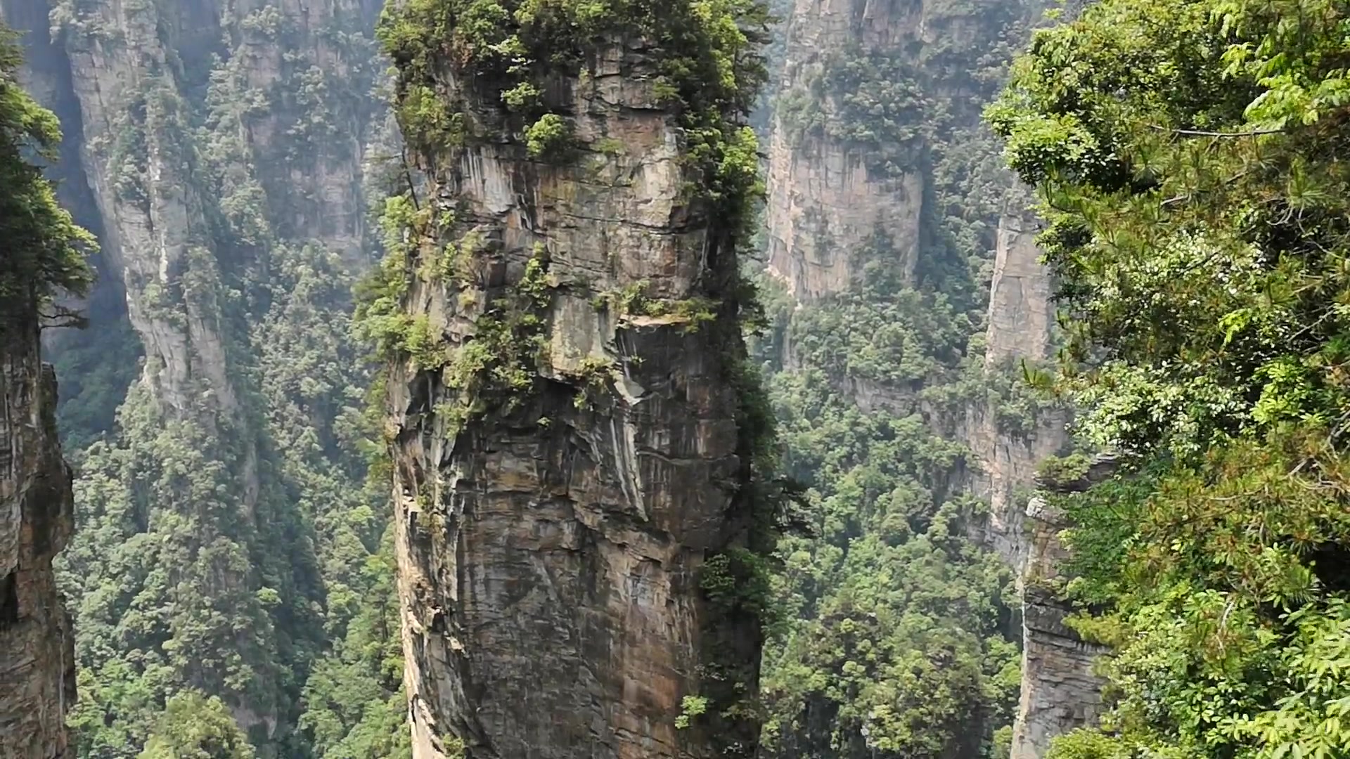
The rock towers rise from a landscape thick with trees, creating narrow vertical islands of greenery. Viewed from above, the gaps between them make the whole scene feel unusually deep: a single frame can contain the cliff face, its wooded summit and the forest far below.
UNESCO describes Wulingyuan as having more than 3,000 narrow quartz sandstone pillars, many over 200 metres high. That helps explain the scale of the landscape in our footage. It is a place of peaks, ravines and forest, rather than one isolated rock formation.
For reliable background and the official name of the protected area, start with UNESCO’s Wulingyuan listing.
2. Zhangye: hills with sweeping bands of colour
Where: Near Zhangye, Gansu Province, northwestern China. Useful search terms include “Zhangye Danxia rainbow hills” and “Zhangye UNESCO Global Geopark.”
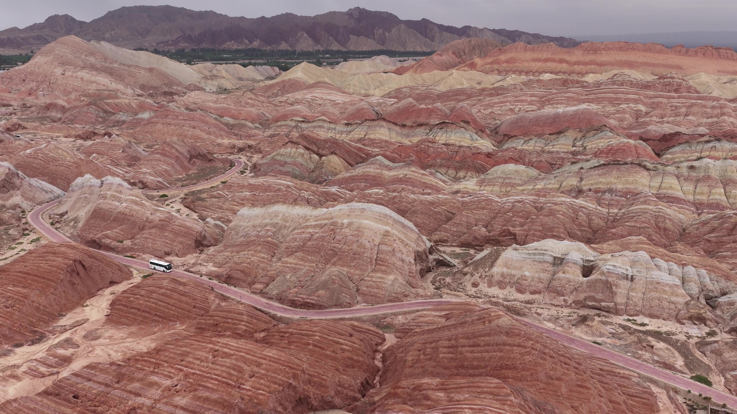
Here the spectacle comes from the layers. Bands of differently coloured rock trace the curves of the hills, making the slopes look almost painted. The broad aerial view in our video shows how those stripes continue across the landscape.
UNESCO identifies colourful, folded sandstone hills as a defining feature of the Zhangye geopark. The geology creates the pattern; light, weather and a photographer’s processing can affect how vivid it appears in an individual image. The footage is credited to its original creator rather than presented as our own photography.
Read more on UNESCO’s Zhangye Global Geopark page. A UNESCO Global Geopark designation is distinct from inscription on the World Heritage List.
3. Salar de Uyuni: a landscape that reflects the sky
Where: The Altiplano of southwestern Bolivia, near the town of Uyuni. Search for “Salar de Uyuni,” rather than simply “Bolivia mirror lake.”
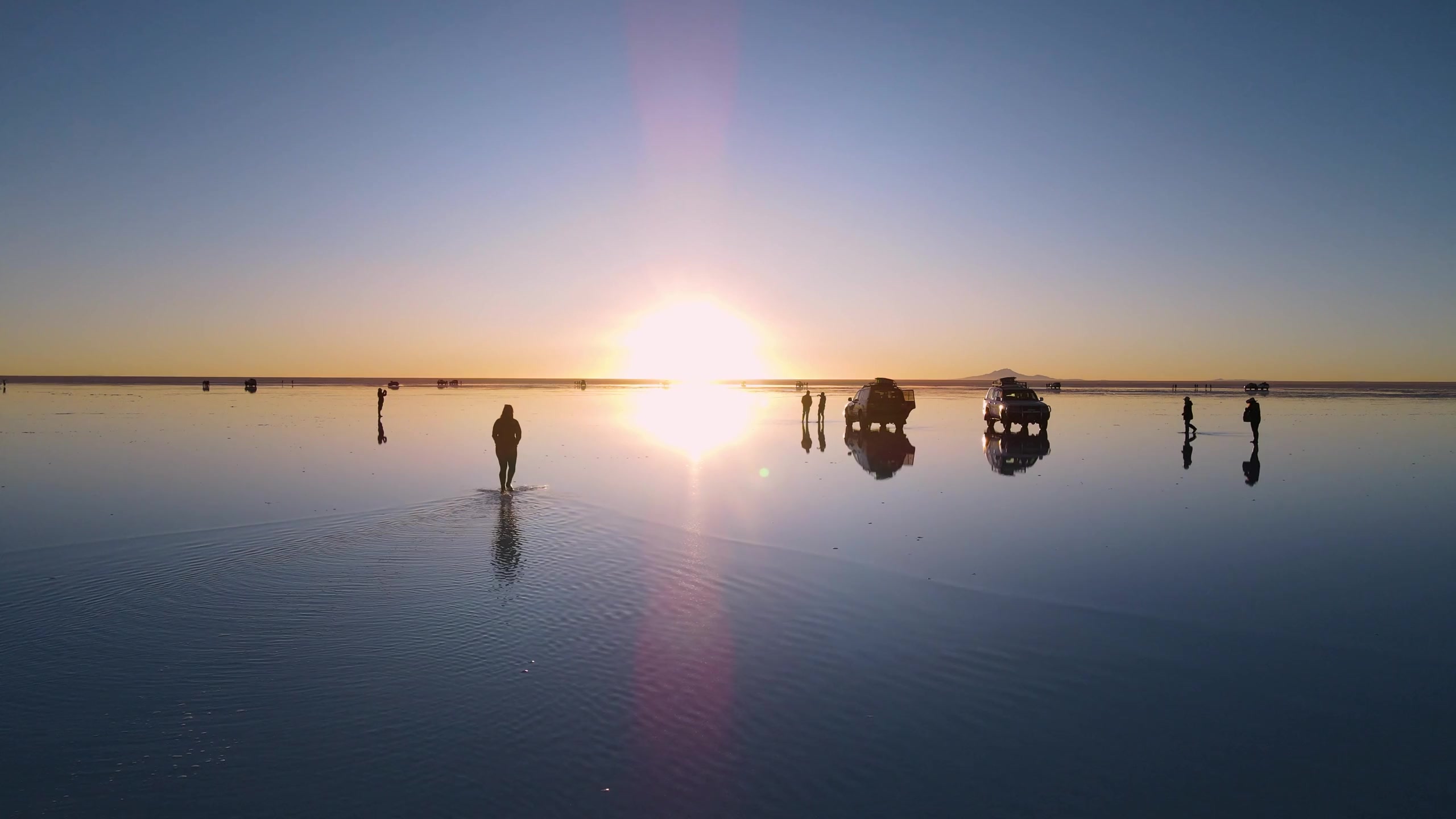
The last location swaps towers and stripes for a vast, open horizon. In the footage, silhouettes and the setting sun reflect across the surface, making it difficult to tell where the land ends and the sky begins.
Salar de Uyuni is the world’s largest salt flat. NASA explains that water can cover parts of it during the rainy season and create its mirror-like appearance. The reflection depends on conditions: the name describes a salt flat, and the mirror effect is not guaranteed every day.
For the science behind the reflection, see NASA’s explanation of Salar de Uyuni.
Which one belongs on your list?
Zhangjiajie offers extraordinary height, Zhangye offers striking patterns and Salar de Uyuni offers a seemingly endless reflection. Keep the full place names and countries handy when researching them: a short clip shows the spectacle, while official destination information helps you understand the place.
Imagery: frames from the footage used in our video, credited individually above. These are third-party views of the destinations, not photographs taken by Way Too Awesome.